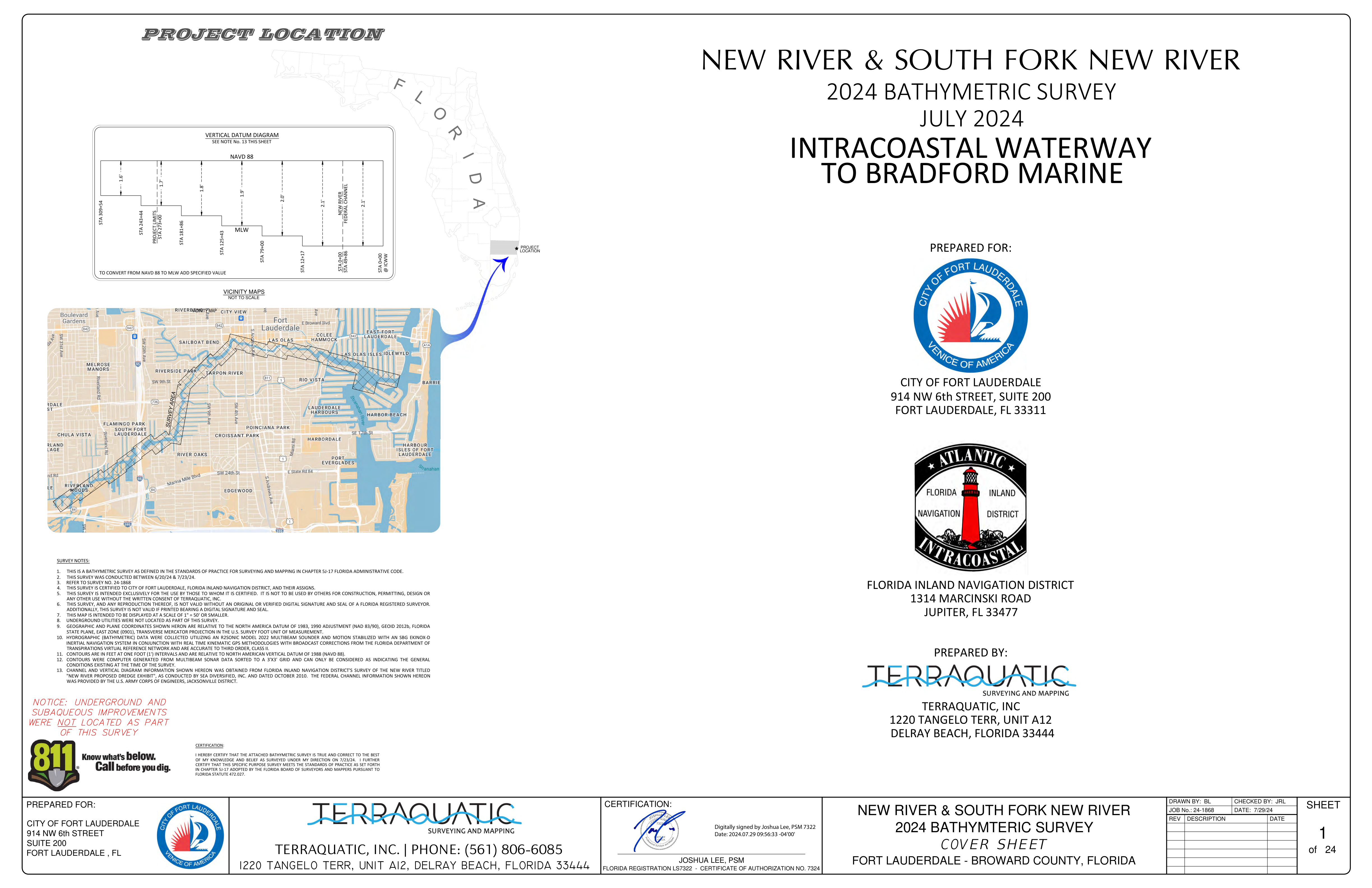
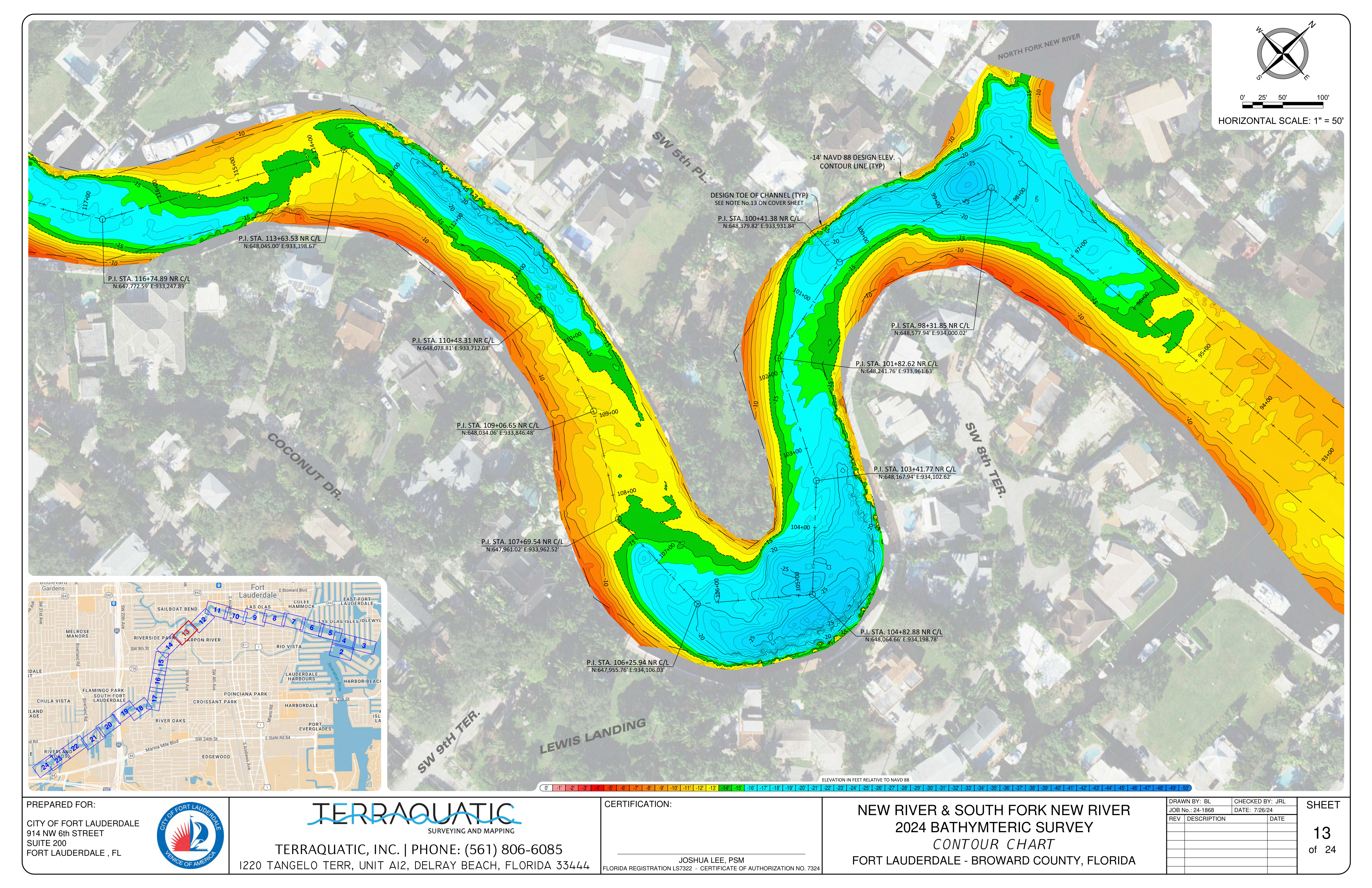
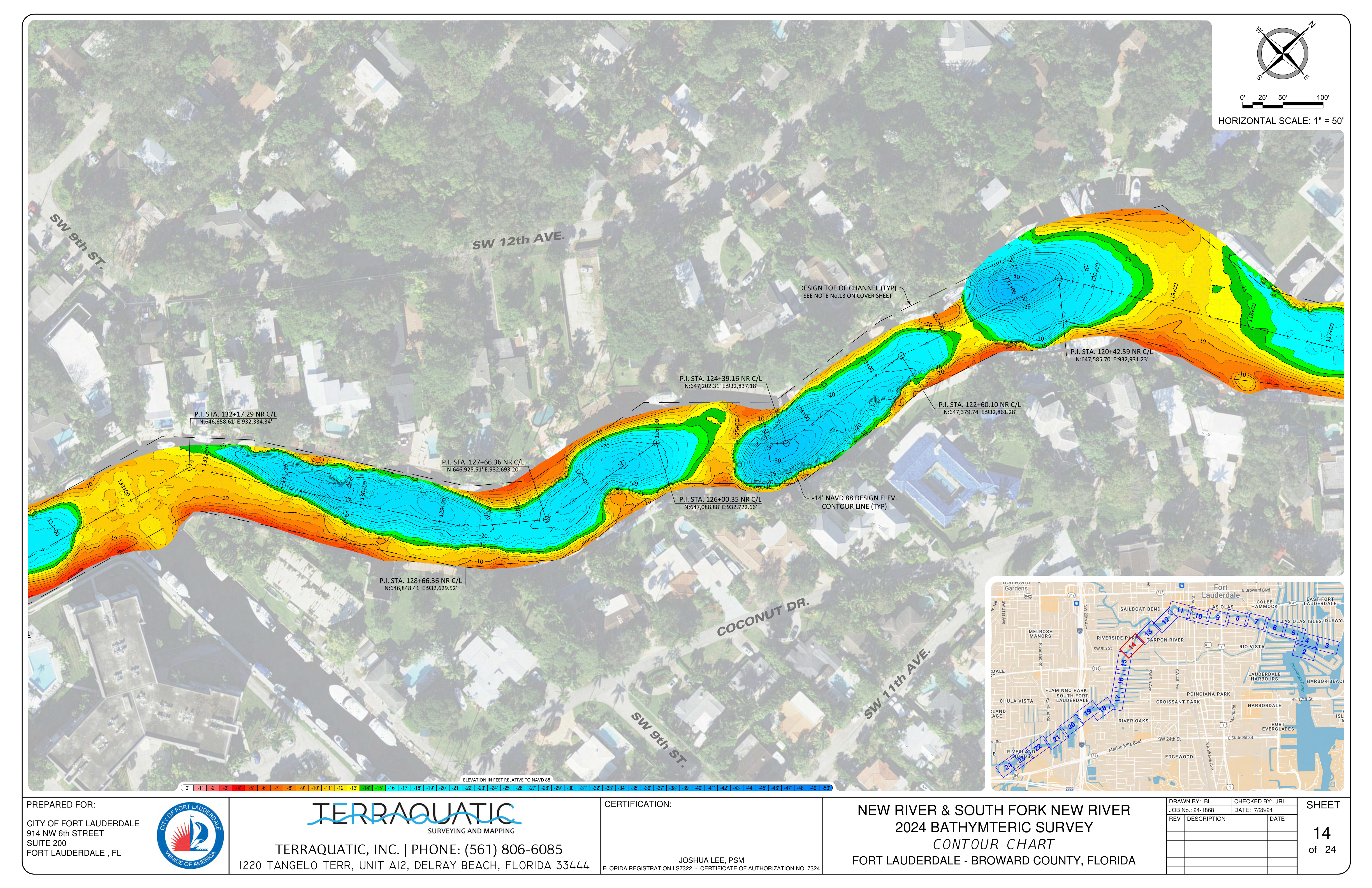
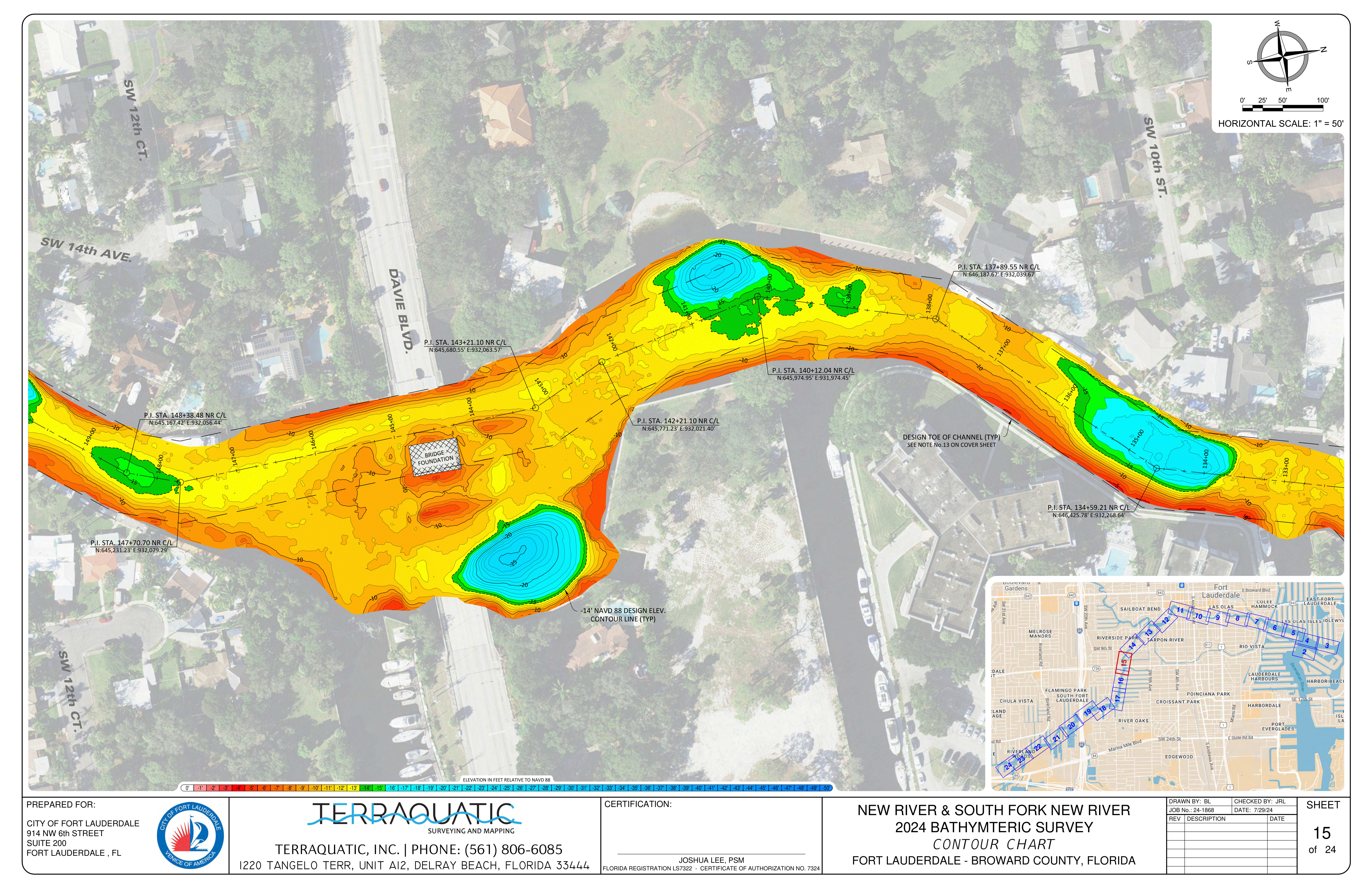
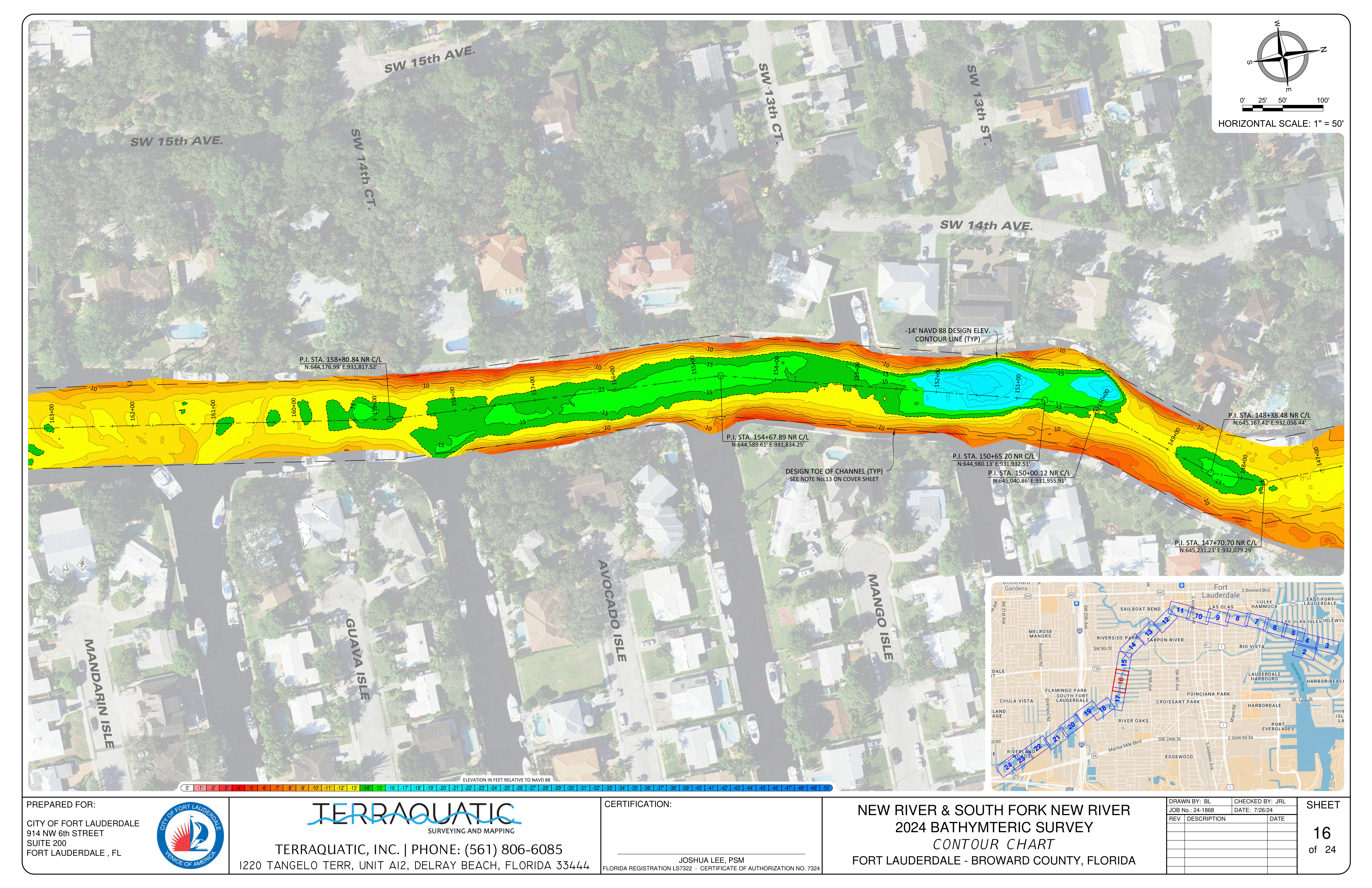
Official City of Fort Lauderdale hydrographic survey data detailing the true channel depths and contour lines along the New River.
Scroll down to view all 24 sheets.
📐
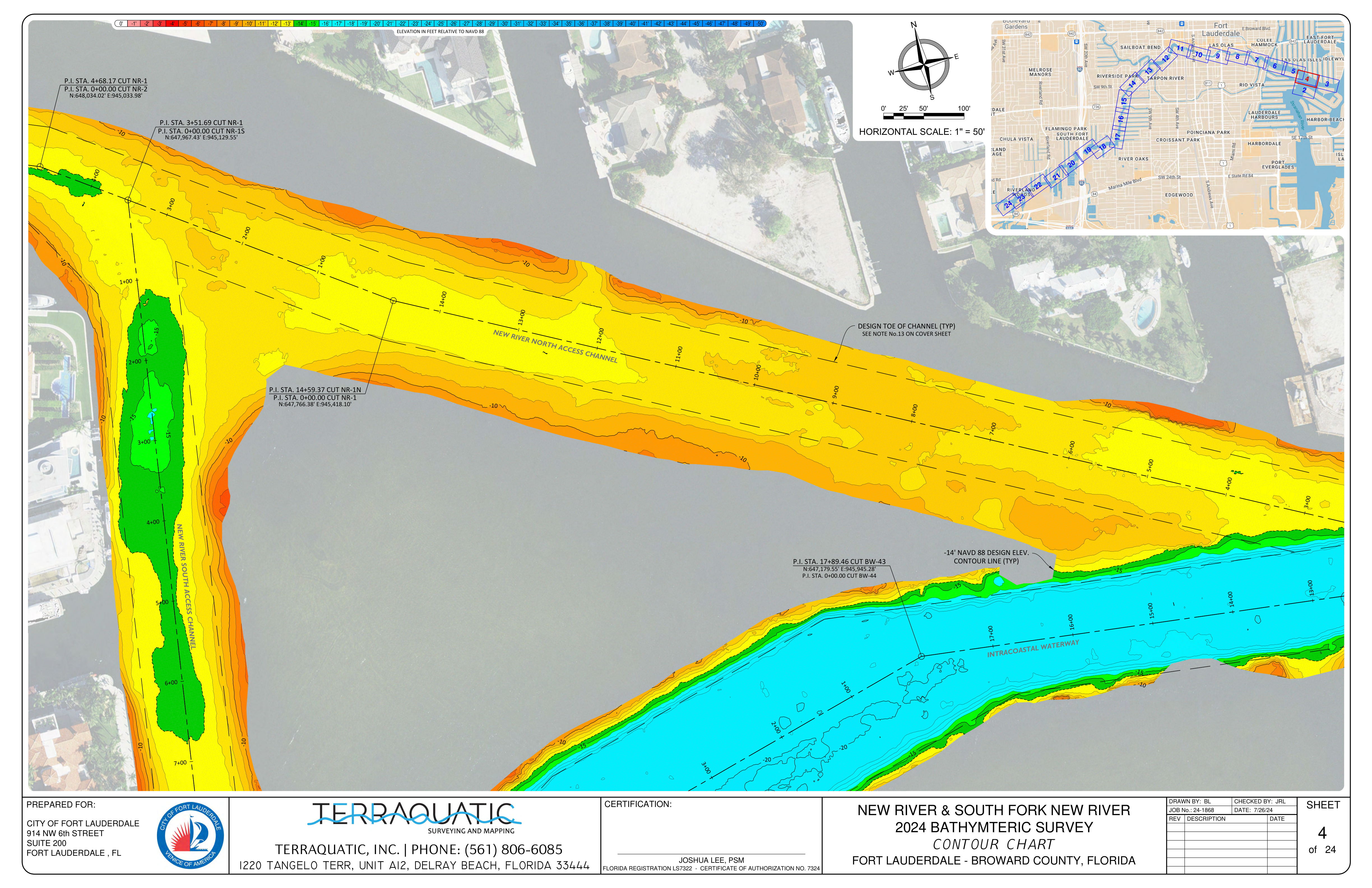
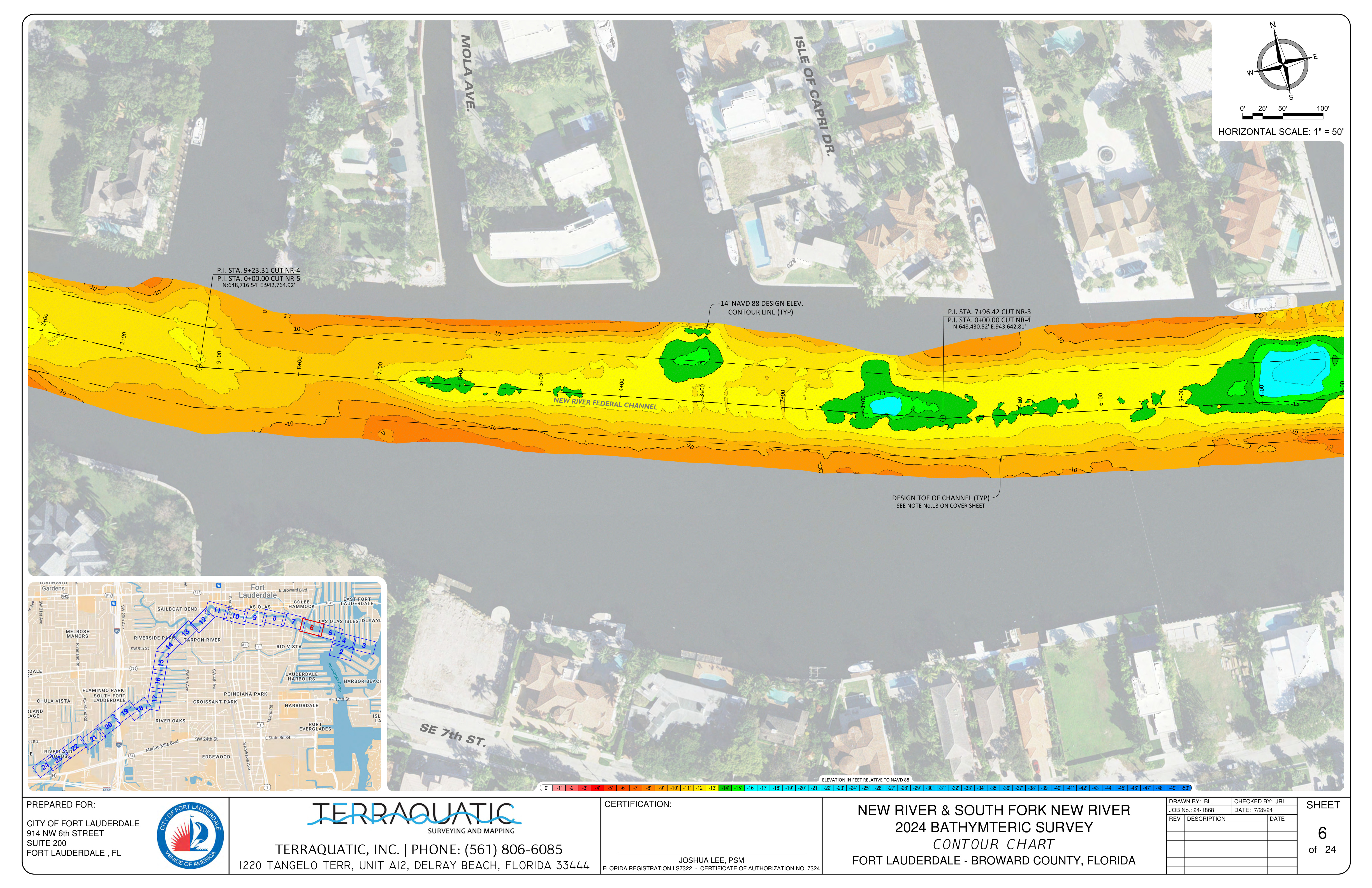
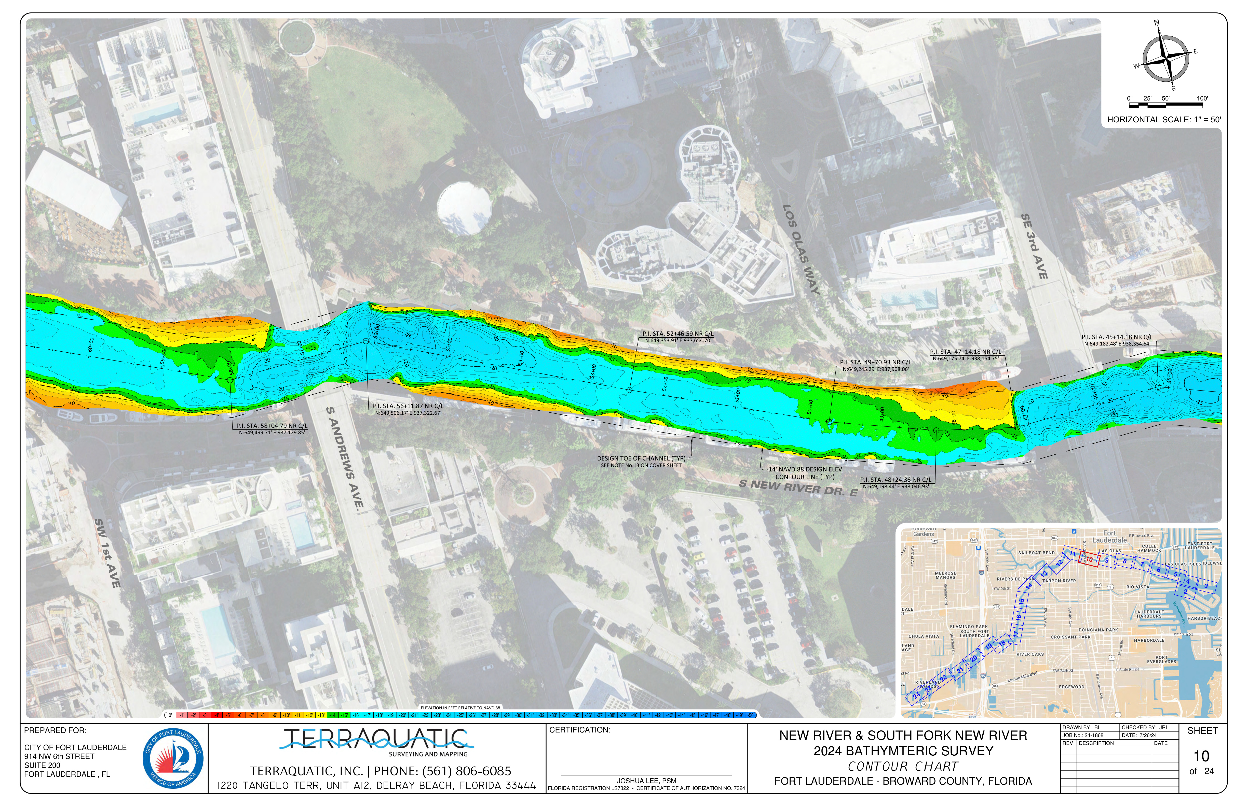
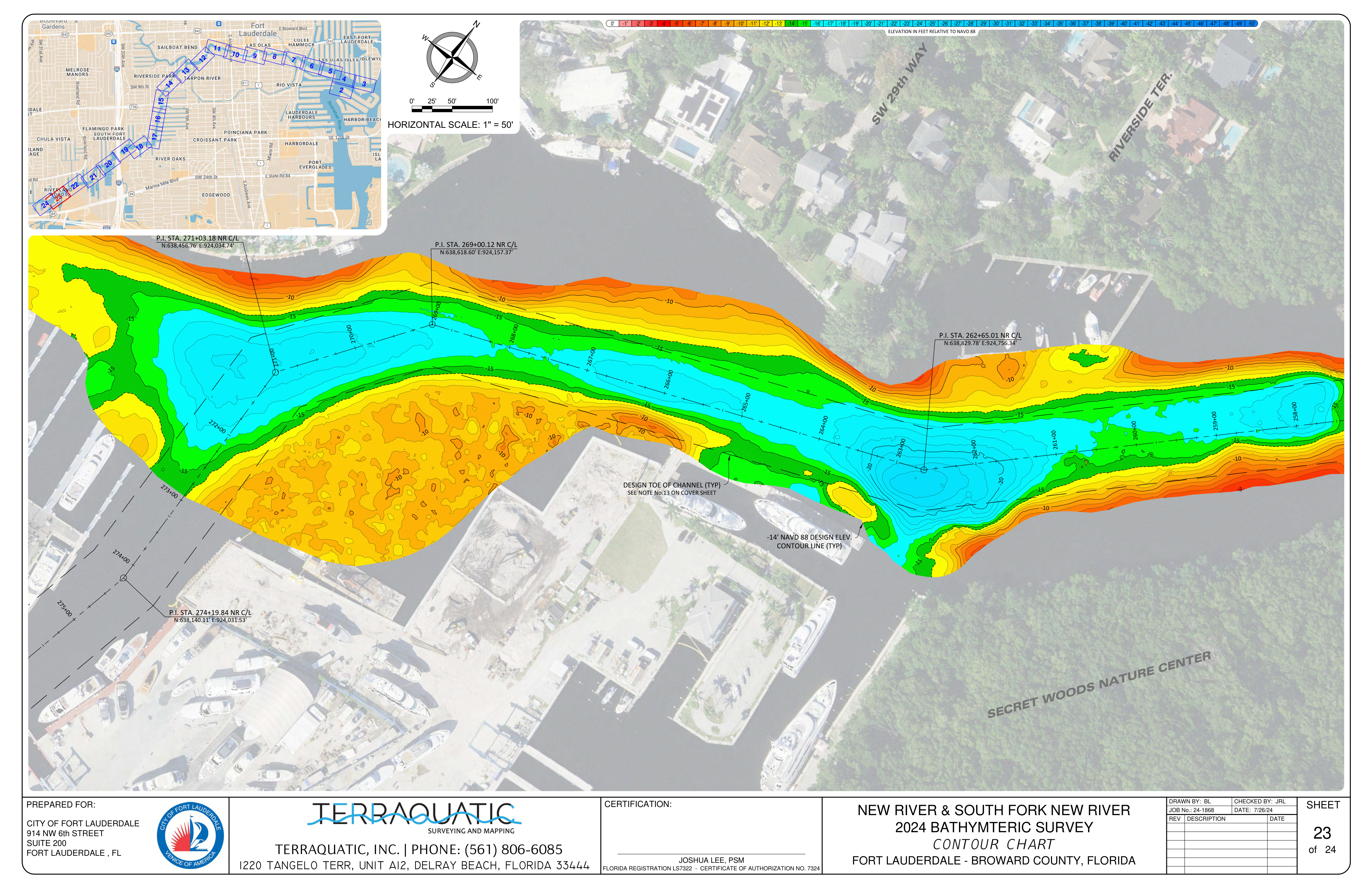
About this data: This continuous survey maps the underwater topography of the river.
Use these charts to identify shallow sections and understand the exact navigable draft available for large vessels.
Survey Sheet 1
Survey Sheet 2
Survey Sheet 3
Survey Sheet 4
Survey Sheet 5
Survey Sheet 6
Survey Sheet 7
Survey Sheet 8
Survey Sheet 9
Survey Sheet 10
Survey Sheet 11
Survey Sheet 12
Survey Sheet 13
Survey Sheet 14
Survey Sheet 15
Survey Sheet 16
Survey Sheet 17
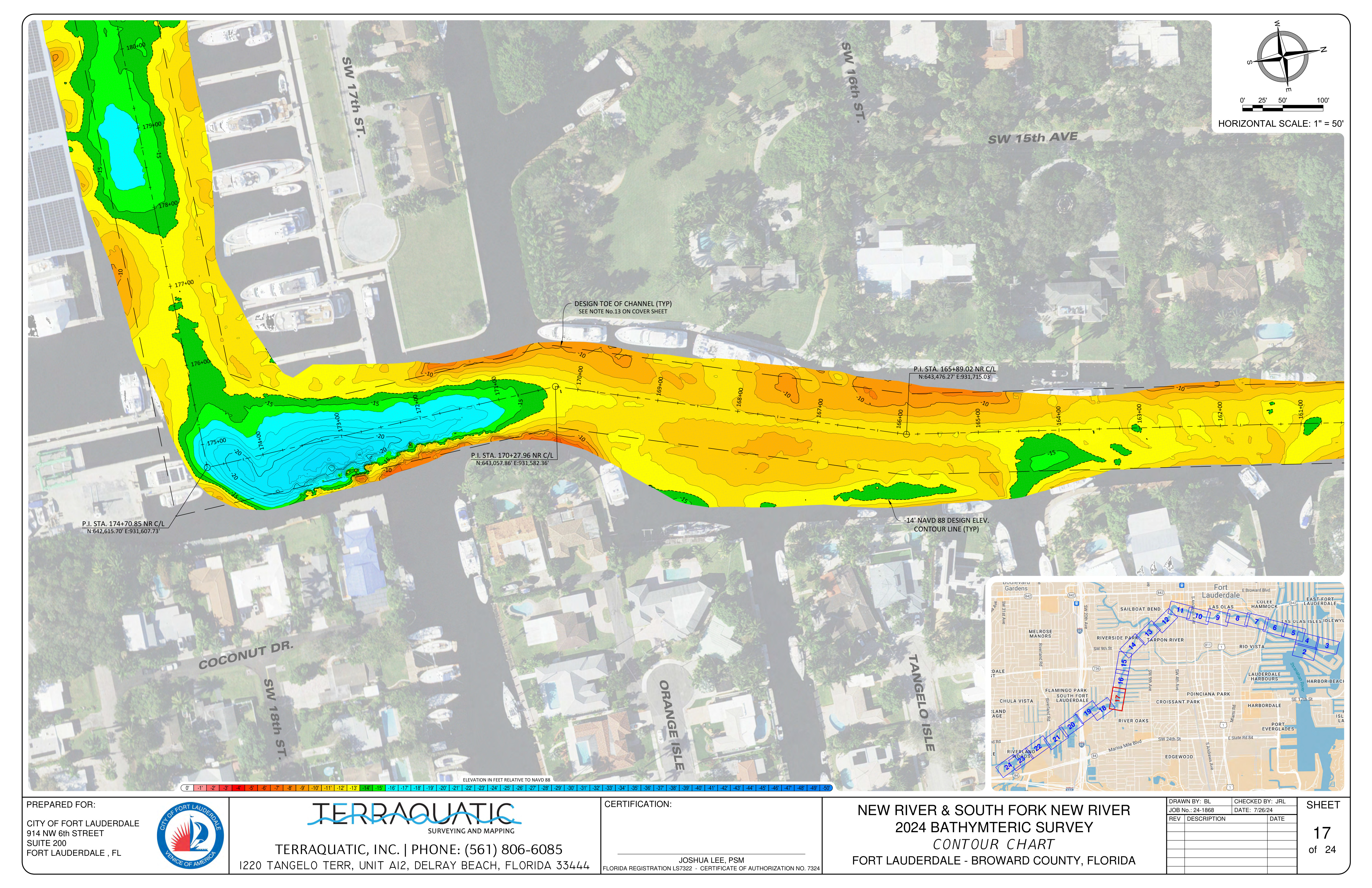
Survey Sheet 18
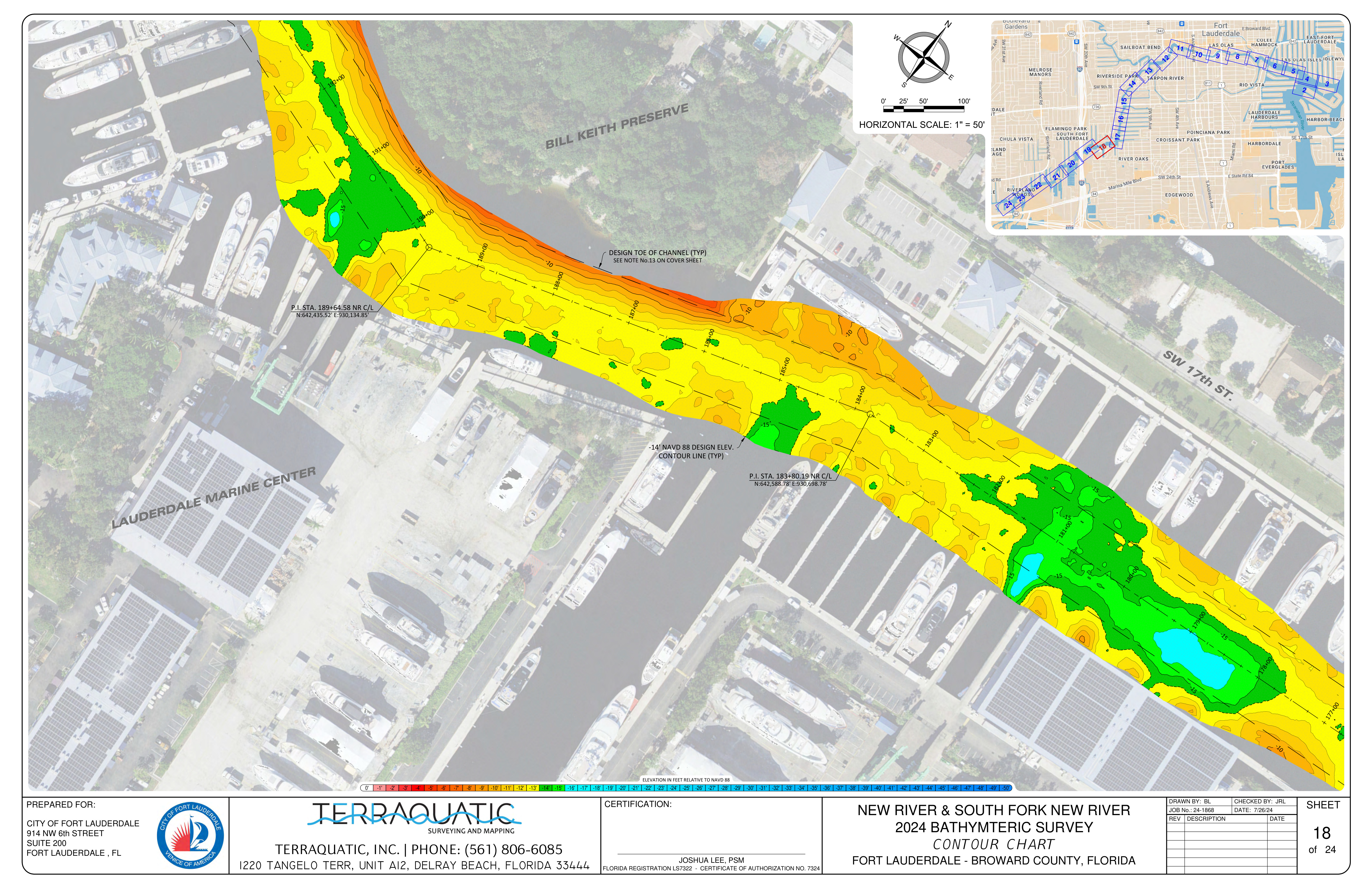
Survey Sheet 19
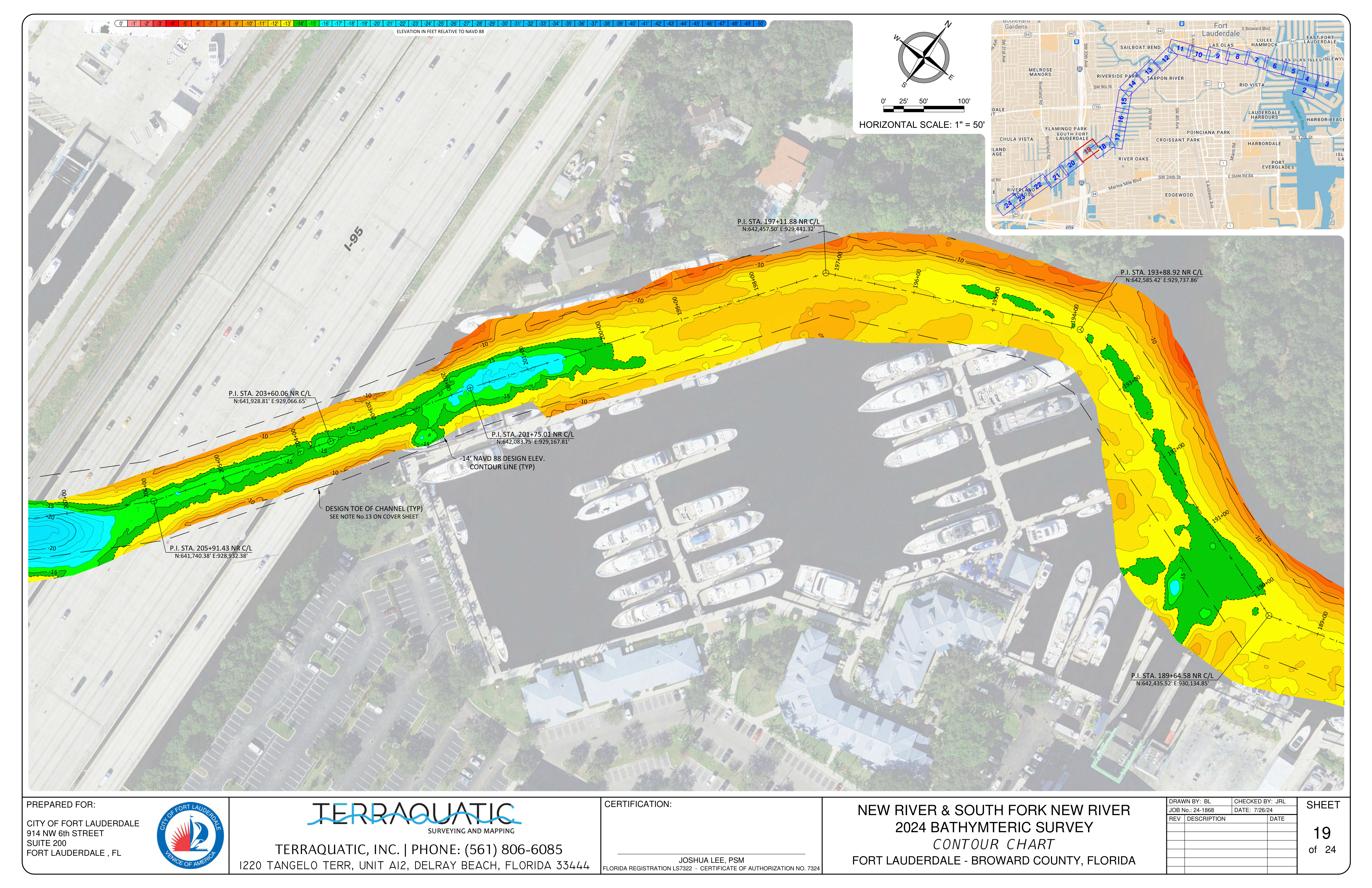
Survey Sheet 20
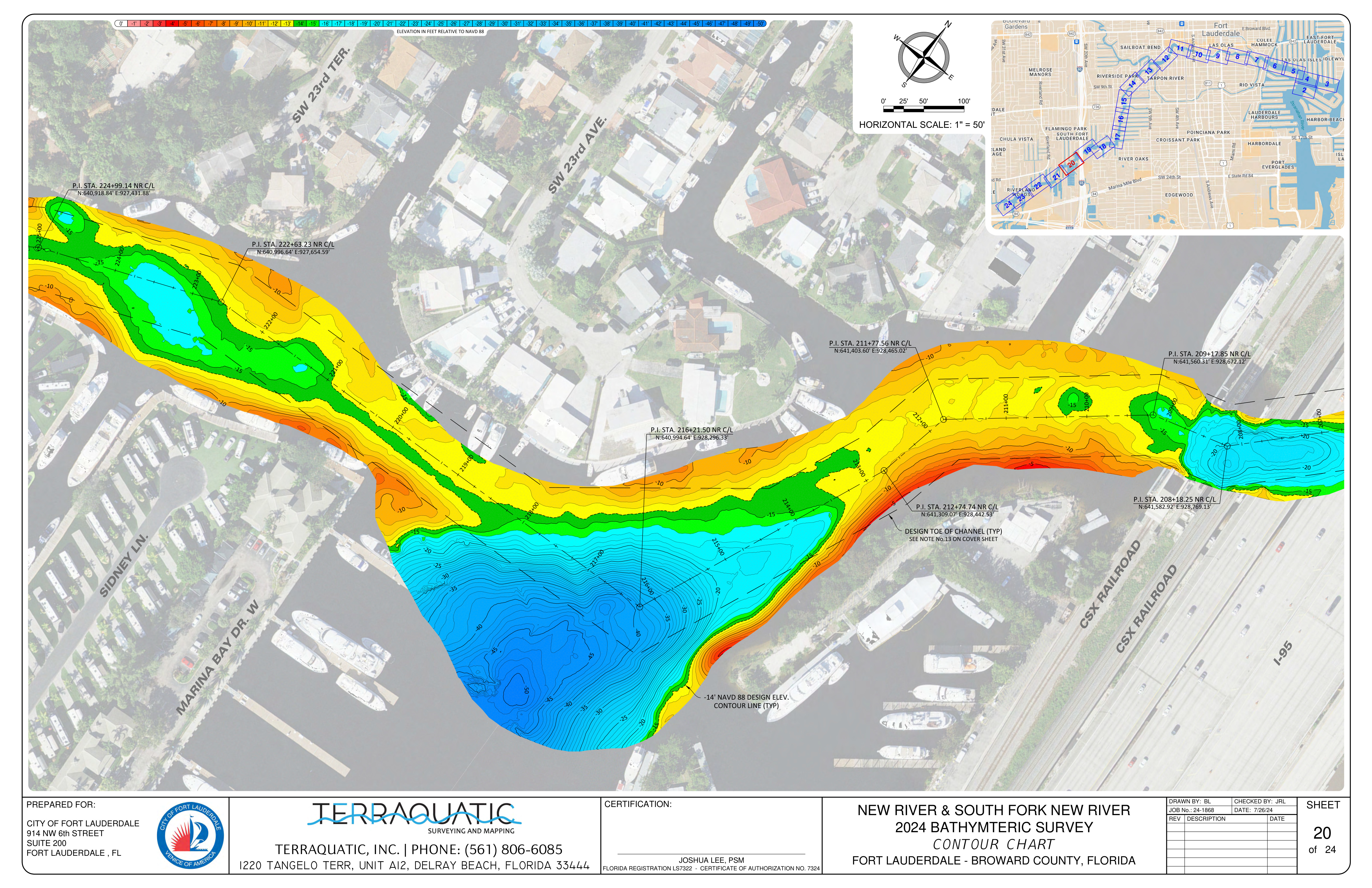
Survey Sheet 21
Survey Sheet 22
Survey Sheet 23
Survey Sheet 24
⚓
Up Next
See the Solution Framework
Depth data and channel width geometry together make the case. Learn the three concrete steps the City can take now to define navigable corridors before physics makes the decision instead of policy.